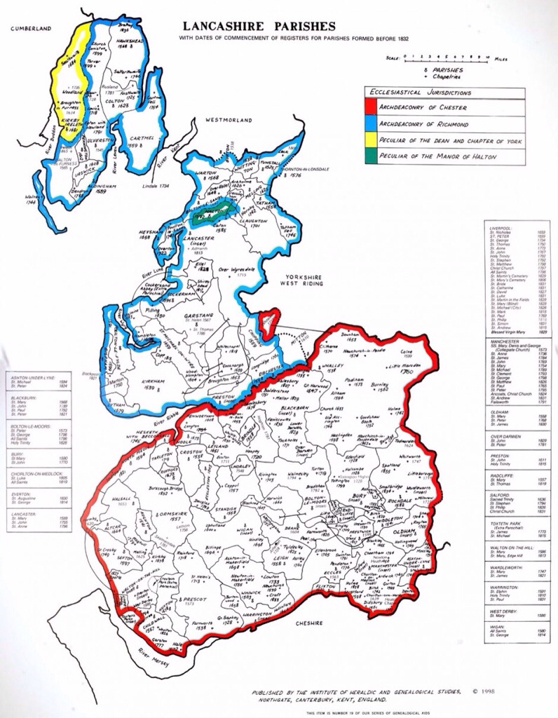
A historical atlas which shows Lancashire in its original form, has been published online for the first time.
The atlas, features counties no longer in existence and ancient parish and county boundaries.
Historical Lancashire comprised Manchester and Liverpool as well as parts of Cumbria and Cheshire. It was subsequently reorganised and downsized as part of the 1974 Local Government Act, losing nearly a third of its area in the process.
The fifty seven maps have been digitised by the family history website Ancestry, and show how Britain’s ancient parish and county boundaries have changed shape over the centuries.
The project was devised by Cecil Humphery-Smith, a genealogist and heraldist who founded the Institute of Heraldic and Genealogical Studies, based in Canterbury, which promotes family history through courses and its extensive library.
Included in the project are eight million records added to the Lancashire Parish records currently available on the site


