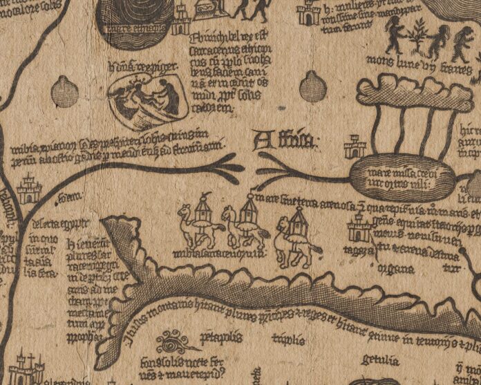
The John Rylands Heritage Imaging Lab team have digitised a unique world map printed from a cast of a circular metal map which is preserved in Cardinal Stephan Borgia’s Museum at Velletri.
The digitalisation had used the new Selene system
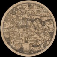
The ‘Borgia’ map is possibly one of the earliest printed.
Purchased in Venice by famed map historian Adolf Erik Nordenskiöld, his research suggests that it could date as far back as 1410, however this is disputed. The map provides an indication of the geography of different countries and offers vibrant descriptions of their ethnography, natural conditions, religion and significant events in history. The map is oriented with south at the top.
The Selene system allows incredibly detailed imaging of the map. The camera moves on an X-Y axis and takes 4 images per tile with light coming from 4 directions (one direction per image). for the imaging of the Borgia Map the System took 1936 images in total, over 484 tiles.
The images are then digitally stitched together to create a super high-resolution composite image. The direction of light can be altered as well as very precise measurements of the surface texture being taken. This session generated 1.27tb of data in total.

