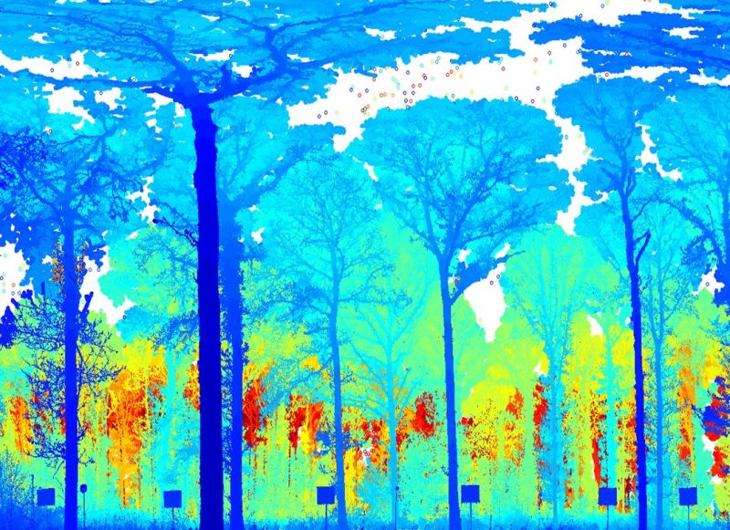
Geographers at the University of Salford are developing laser technology to help protect the world’s forests and woodlands.
Terrestrial laser scanners are set to revolutionize the way in which ecologists measure forests, and will help confer a value on these natural ‘carbon sinks’ as counters to the greenhouse effect and global warming.
A gathering of the world’s leading researchers on the subject under the auspices of the Royal Society was organised by Professor Mark Danson from the School of Environment and Life Sciences to discuss the latest developments and thinking in a field.
The two-day meeting at the Royal Society’s country venue, Chicheley Hall, in Northamptonshire titled “The Terrestrial Laser Scanning Revolution in Forest Ecology” featured a star line-up of keynote presentations by researchers from the UK, US, Germany, Finland, Australia, China and Switzerland with other participants representing a further five countries.
Danson, Professor of Environmental Remote Sensing, explained: “Terrestrial laser scanners work by firing millions of laser pulses up into the forest canopy. The information recorded can then be used to monitor changes in forest structure and biomass with unprecedented accuracy. This includes the prospect of our being able to better quantify the storage of carbon in such ecosystems.
“Effectively we can ‘weigh trees with lasers’ based on three-dimensional reconstructions of complete forests, which is truly exciting.”
Professor Danson used the meeting to describe how a new device, the Salford Advanced Laser Canopy Analyser, or SALCA for short, can be used to map the growth and fall of leaves in UK woodlands.


